-
LAO
... transcribed Sathalanalat Paxathipatai Paxaxon Lao is the only landlocked country in Southeast Asia. The state of Laos borders China, Vietnam, Cambodia, Thailand and Myanmar and has about 6.5 million inhabitants on an area of 236,800 square kilometers; Capital and largest city is Vientiane.

Population:
The population of about 6.5 million is very unevenly distributed over the territory. The greatest population density have the levels on the Mekong, including especially the region around the capital. The mountainous areas in the east and north are very sparsely populated. Less than a third of the population lives in cities. The largest metropolitan center, Vientiane, has a population of about 600,000Flora and Fauna:
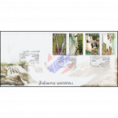
The country is forested about 50%. There are both rainforests with tropical plants and monsoon forests. Around 8% of the forests are classified as virgin forest. Laos is home to predators such as leopards and tigers. Working elephants are used as pack animals, as in the other countries of Southeast Asia.Climate:
It has a tropical climate with high temperatures, which may be caused by the large differences in height to strong temperature fluctuations. The climate is extremely influenced by the monsoon. From 05 to 10 there is the southwest monsoon, which is associated with rainfall and high humidity. During this time, the rainfall averages 1778 mm, while between 11 and 02 the northeast monsoon has a dry and cooler climate. In the months 03 and 04 the climate is humid & hot. Location:
The narrow southern part of Laos is on the Indochinese peninsula between Vietnam to the east, Cambodia to the south and Thailand to the west. The northern part of the country lies on the actual Southeast Asian mainland, here Laos also shares borders with Myanmar and the southern Chinese province of YunnanLaos can be topographically divided into two areas:
-An area dominated by mountains extends in a north-south direction almost through the entire country, reaching heights above 2000 meters, its highest mountain is the Phu Bia with 2,819 m. This mountainous region covers about nine-tenths of the country.
-The rest of the region, which also includes the capital Vientiane, is a small lowland on the south and southwestern border with Thailand.
The most important river is the Mekong River, which rises in Tibet and ramifies in Ho Chi Minh City (Vietnam) into a river delta that extends over 39,000 km². The Mekong Delta drains into the South China Sea. The Mekong forms the border to Thailand and also to Myanmar on a length of about 1000 kilometers; in total, it touches Laotian territory at 1,898 kilometers. The largest part of the country thus drains into the South China Sea. Only 12% of the territory, to the northeast, drown in the Gulf of Tonkin. On the Mekong lie the capital Vientiane and the city of Luang Prabang. Other important rivers are Nam Ou, Nam Ngum and Nam Xebanghieng.
-
-

-
Vintages
Please note: With Laos issues up...
-
-
-
-
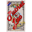
Pathet Lao
The Pathet Lao was a communist...
-


Top offers
-

6th anniversary of the founding of the People's Republic (MNH)
C$ 481,05
Final price*, plus shipping
-
Twinning between Keng-Kok and Saint-Astier, France -PROOF / DELUXE SHEET- (MNH)
C$ 240,53
Final price*, plus shipping